
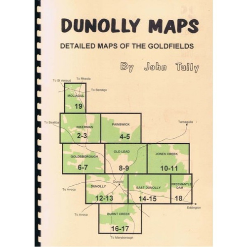
John Tully Dunolly Goldfields Map
$21.00

 WARRANTY ON ALL OUR GEAR
 CERTIFIED MINELAB DEALER
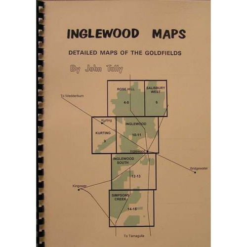
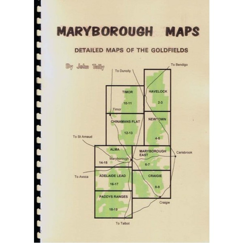
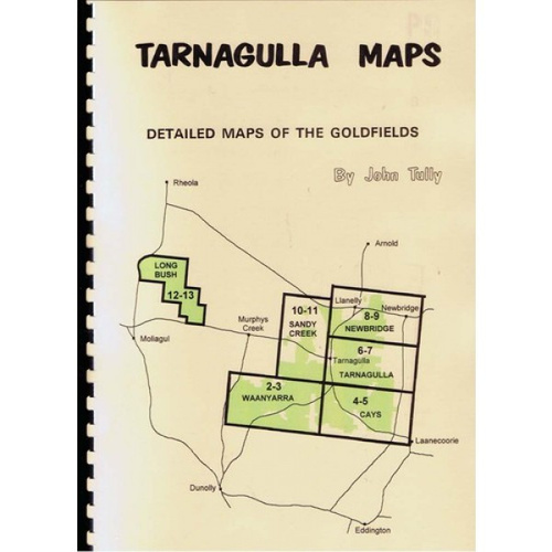
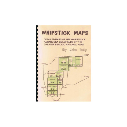
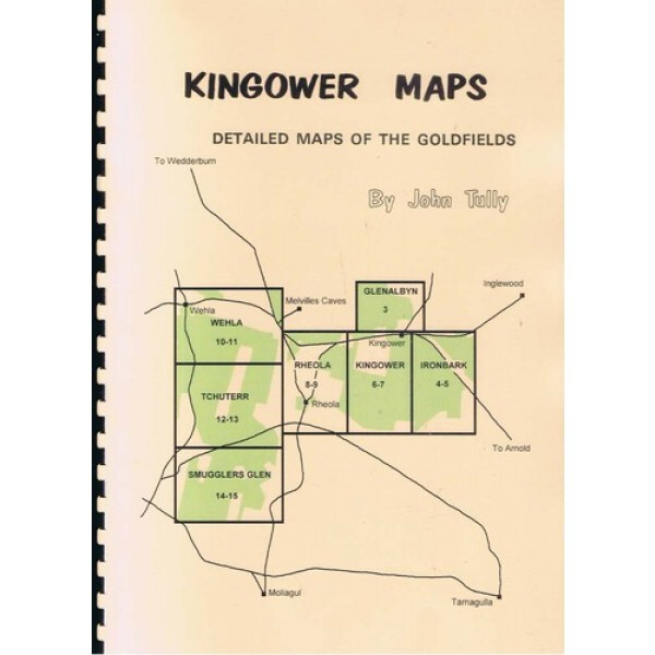
This set of fine detail maps covers the Kingower goldfield in Victoria and includes the surrounding areas of Rheola, Wehla, Glenalbyn and Smugglers Glen. They have been compiled from extensive research of early survey maps, reports and other Mines Department records, contemporary newspaper articles, interviews with local identities and personal observation. These maps highlight the difference between private and public land regardless of whether it is forested or not. Also on these maps are current roads, bush tracks, dams, alluvial gold workings, reef mines and places of historic interest. The author has driven down the roads shown on these maps in a two-wheel drive vehicle. Be warned a number of the tracks shown as broken lines on these maps are not suitable for 2 wheel drive vehicles in all seasons. Bush tracks and sometimes even their names are subject to change. Weila Publishing accepts no liability as to the inaccuracy of these maps. Permission for some activities or even access may be required for some public land.
About the Author:
John Tully arrived in Dunolly on a detecting holiday in 1980. He found gold and has remained there ever since learning much about the occurrence of gold and history of the area. Amongst John’s series of maps and books is the story of a Chinese miner, A Difficult Case, which was co-authored with the late Ruth Moore of Castlemaine. This was runner up, Best Victorian History Book in the Victorian Community History Awards 2001. John Tully has been President of the Goldfields Historical & Arts Society Inc (Dunolly Museum) since 1989.
Help other Miners Den Australia users shop smarter by writing reviews for products you have purchased.
Write a product review
LOCATE A STORE
Find the your nearest Miners Den store

DELIVERY
We strive for the fastest possible delivery time with an option of shipment tracking.

HUMM 90 FINANCE
Buy now, pay later- 12 month interest free finance.

SELL YOUR DETECTOR
Miners Den can service, test and sell your 2nd hand Minelab metal detector for you!
JOIN THE MINERS DEN CLUB
Sign up to be notified with fresh news and exciting discounts
or
FIND THE PERFECT DETECTOR...